
10th Grade Geography
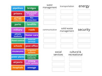
Voorbeelden uit onze gemeenschap
10.000+ resultaten voor '10th grade geography'
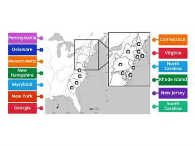
13 Colonies Map Matching Game
Gelabelde afbeelding
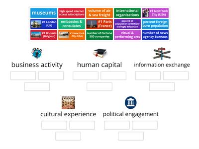
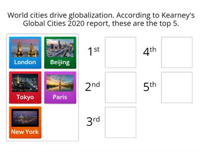
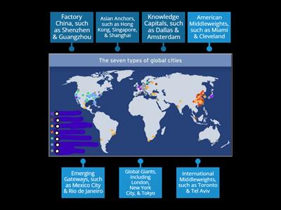
6.3 Cities & Globalization/World Cities 2020
Rangschikken
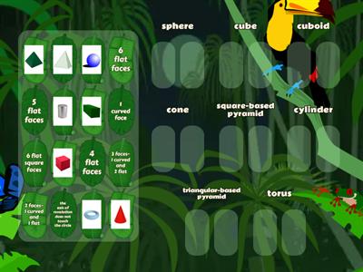
3D shapes, names and faces
Sorteren
LAST NAME, first name
Gelabelde afbeelding
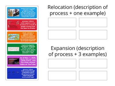
Types of Migration
Verbinden
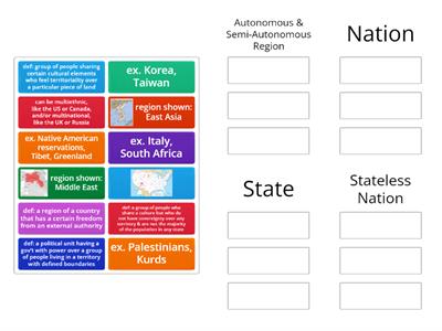
DOL 4.7 Forms of Governance
Sorteren
6.4 Central Place Theory
Rangschikken
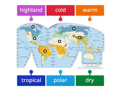
Climate Regions Map
Gelabelde afbeelding
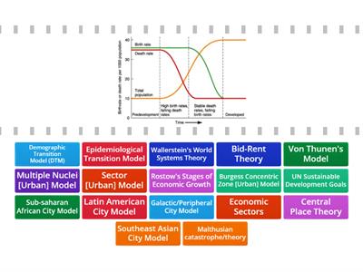
AP Human Geography Models and Theories
Kies het antwoord
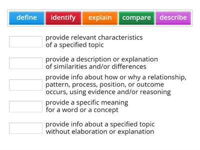
FRQ Task Verbs
Verbinden
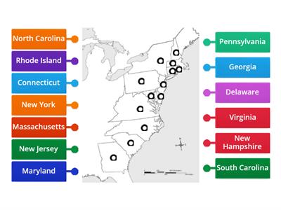
4.5 4.B.1 Nature of Boundaries
Sorteren
Population Pyramid Match up
Verbinden
Urban Geography Models
Verbinden
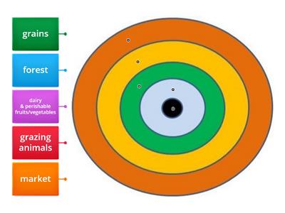
5.8 von Thunen Model
Gelabelde afbeelding
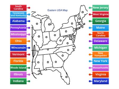
Eastern USA Map Diagram
Gelabelde afbeelding
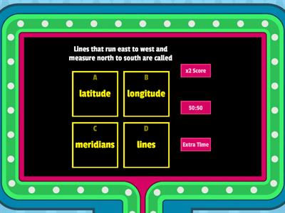
latitude and Longitude
Gameshow quiz
The 13 Colonies
Gelabelde afbeelding

Le parti del corpo
Gelabelde afbeelding
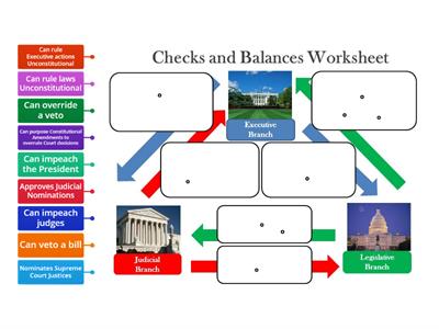
Checks and Balances
Gelabelde afbeelding
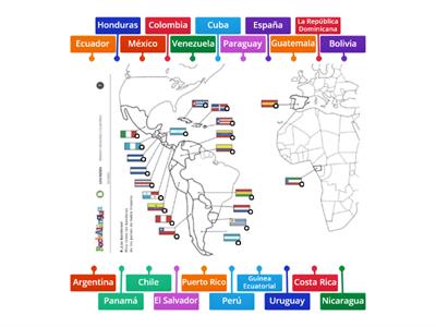
Mapa de países hispanohablantes (Spanish Speaking Countries Map)
Gelabelde afbeelding
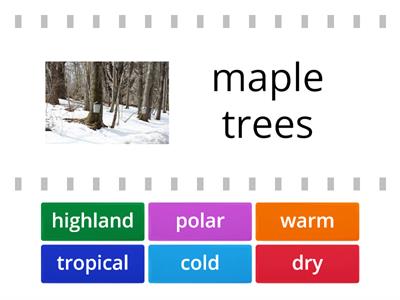
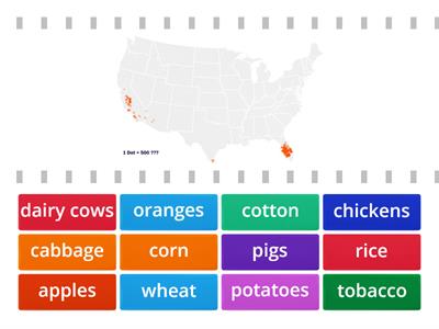
5.1 Intro to Agriculture/Climate
Kies het antwoord
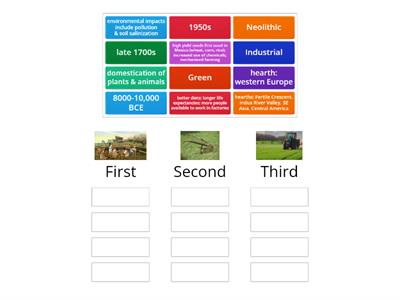
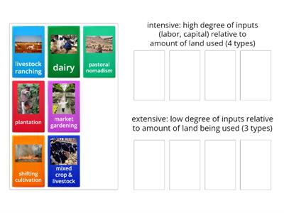
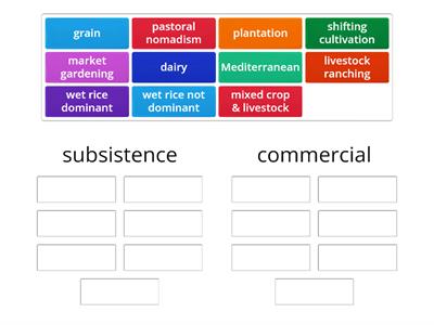
5.3-5 Agricultural Revolutions
Sorteren
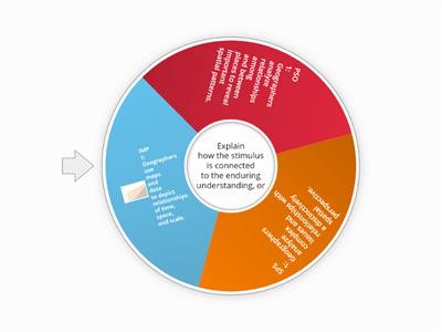
Essential Questions in AP Human Geography Units 1-4
Rad van fortuin
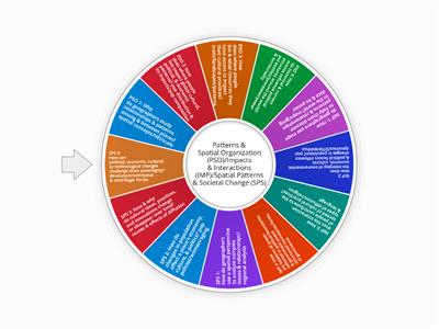
Essential Questions in AP Human Geography All Units
Rad van fortuin
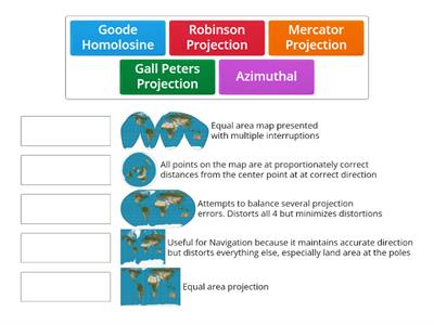
Map Projections Matching
Verbinden
Map Quiz
Gelabelde afbeelding
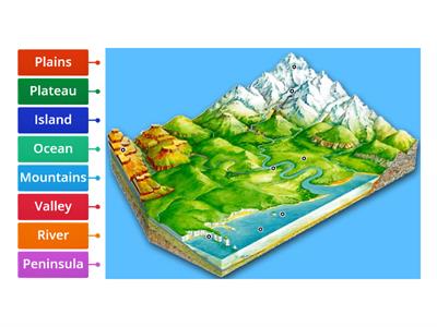
Landforms
Gelabelde afbeelding
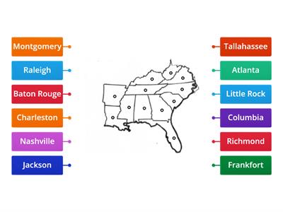
Southeast Capitals Map
Gelabelde afbeelding
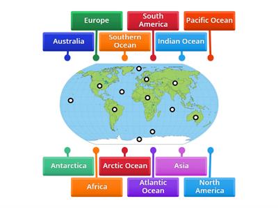
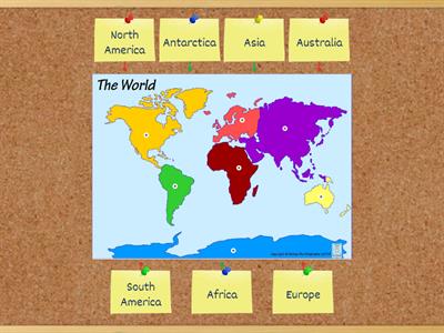
Continents and Oceans Practice Game 1
Gelabelde afbeelding
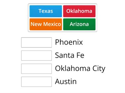
Southwest States & Capitals
Verbinden
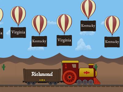
Southeast Balloon Pop
Ballonnen
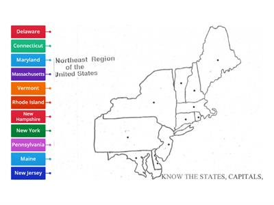
Northeast Map
Gelabelde afbeelding
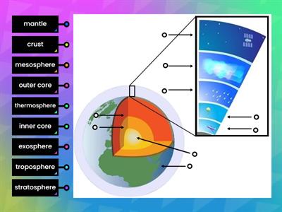
Layers of the Earth and Atmosphere
Gelabelde afbeelding
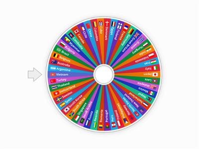
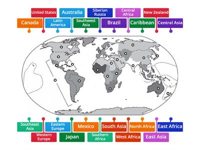
Countries of the World
Rad van fortuin
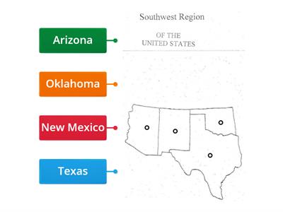
Southwest Region
Gelabelde afbeelding
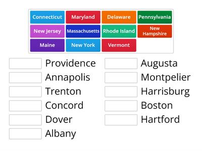
Northeast States and Capitals
Verbinden
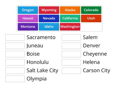
West States & Capitals
Verbinden
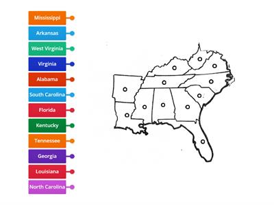
Southeast Region
Gelabelde afbeelding
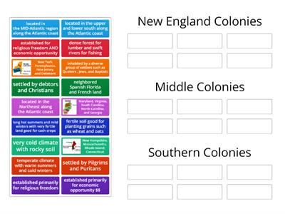
13 Colonies
Sorteren
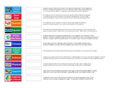
Types of Maps
Verbinden
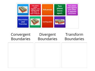
Plate Boundaries
Sorteren
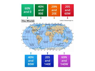
Longitude and Latitude
Gelabelde afbeelding
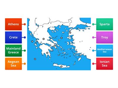
Ancient Greece Map
Gelabelde afbeelding
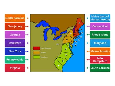
Thirteen Colonies
Gelabelde afbeelding
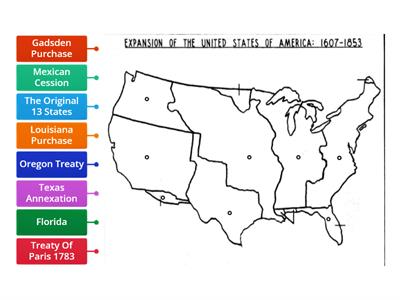
Westward Expansion Map
Gelabelde afbeelding
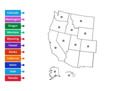
West Region
Gelabelde afbeelding
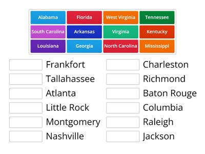
Southeast States & Capitals
Verbinden
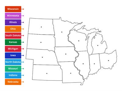
Midwest Region
Gelabelde afbeelding
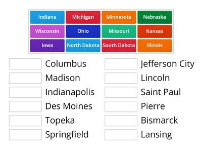
Midwest States & Capitals
Verbinden

