
10th Grade Geography
Przykłady z naszej społeczności
Liczba wyników dla zapytania „10th grade geography”: 10 000+
13 Colonies Map Matching Game
Rysunek z opisami
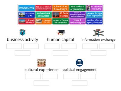
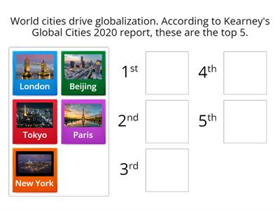
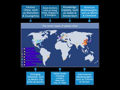
6.3 Cities & Globalization/World Cities 2020
Ustaw w kolejności
3D shapes, names and faces
Posortuj
LAST NAME, first name
Rysunek z opisami
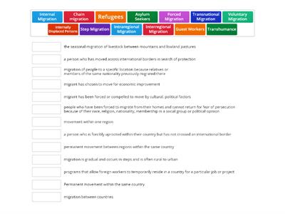
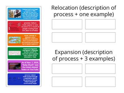
Types of Migration
Połącz w pary
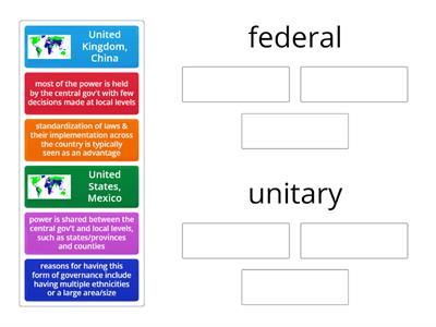
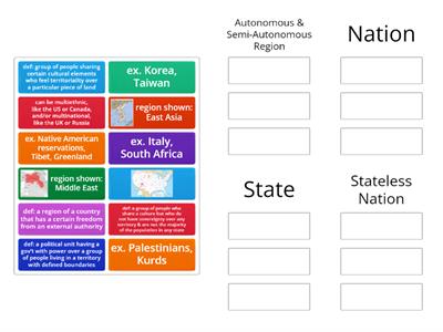
DOL 4.7 Forms of Governance
Posortuj
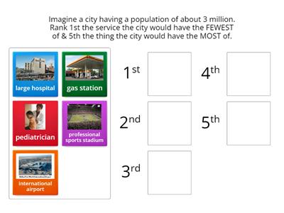
6.4 Central Place Theory
Ustaw w kolejności
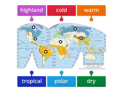
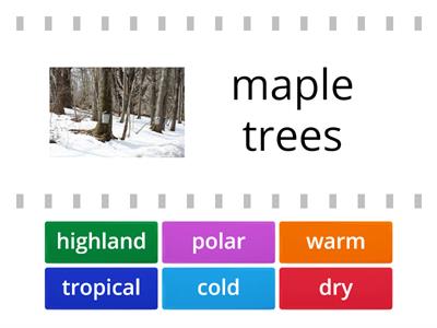
Climate Regions Map
Rysunek z opisami
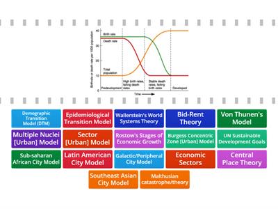
AP Human Geography Models and Theories
Znajdź parę
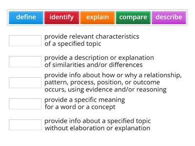
FRQ Task Verbs
Połącz w pary
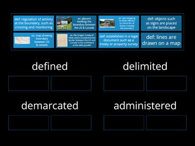
4.5 4.B.1 Nature of Boundaries
Posortuj
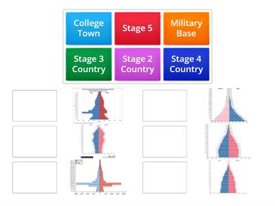
Population Pyramid Match up
Połącz w pary
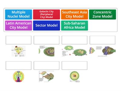
Urban Geography Models
Połącz w pary
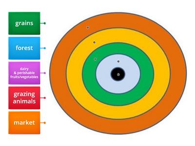
5.8 von Thunen Model
Rysunek z opisami
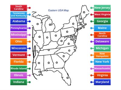
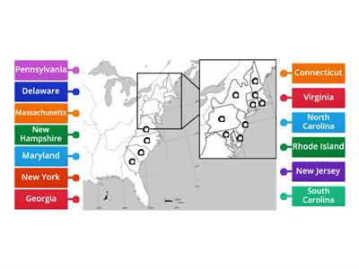
Eastern USA Map Diagram
Rysunek z opisami

latitude and Longitude
Teleturniej
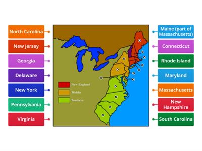
The 13 Colonies
Rysunek z opisami

Le parti del corpo
Rysunek z opisami
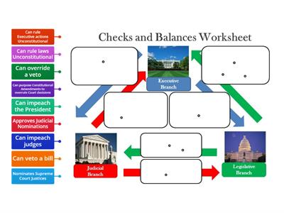
Checks and Balances
Rysunek z opisami
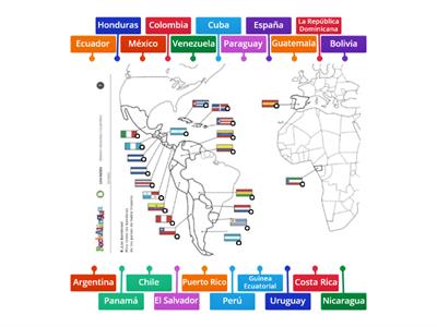
Mapa de países hispanohablantes (Spanish Speaking Countries Map)
Rysunek z opisami
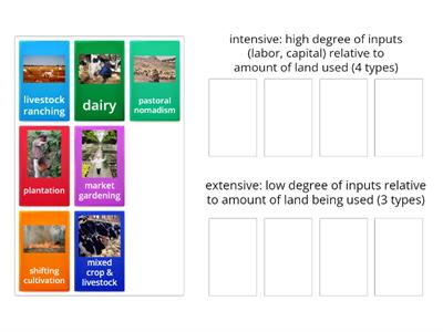
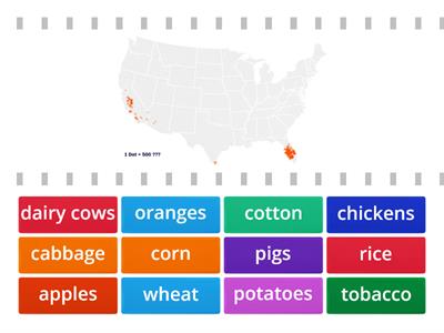
5.1 Intro to Agriculture/Climate
Znajdź parę
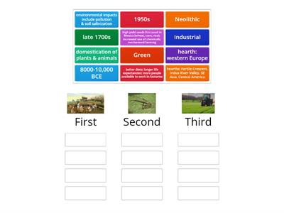
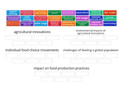
5.3-5 Agricultural Revolutions
Posortuj

Essential Questions in AP Human Geography Units 1-4
Koło fortuny
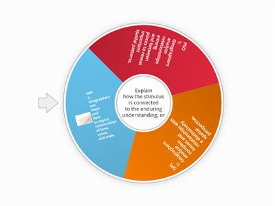
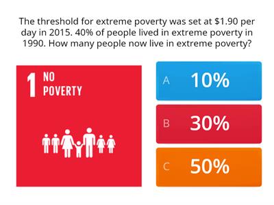
Essential Questions in AP Human Geography All Units
Koło fortuny
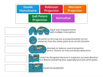
Map Projections Matching
Połącz w pary
Map Quiz
Rysunek z opisami
Landforms
Rysunek z opisami
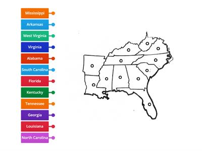
Southeast Capitals Map
Rysunek z opisami
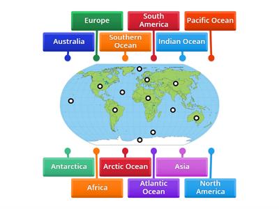
Continents and Oceans Practice Game 1
Rysunek z opisami
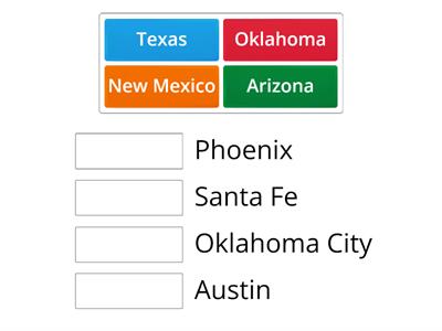
Southwest States & Capitals
Połącz w pary
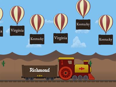
Southeast Balloon Pop
Przebij balon
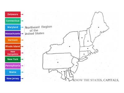
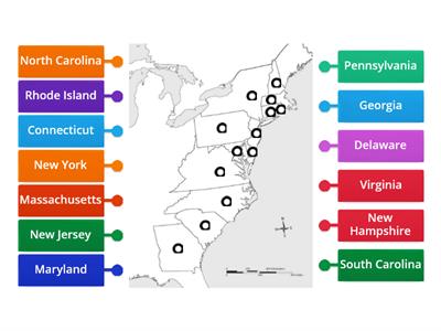
Northeast Map
Rysunek z opisami
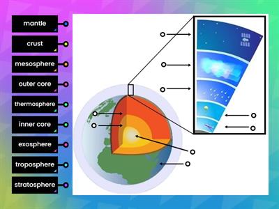
Layers of the Earth and Atmosphere
Rysunek z opisami

Countries of the World
Koło fortuny
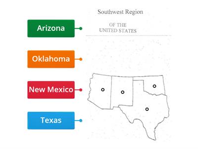
Southwest Region
Rysunek z opisami
Northeast States and Capitals
Połącz w pary
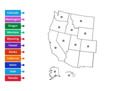
West States & Capitals
Połącz w pary
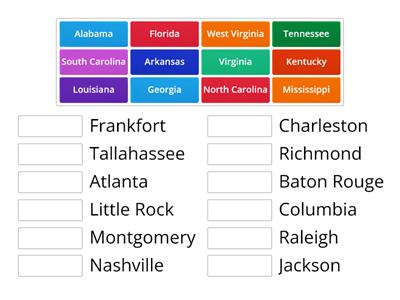
Southeast Region
Rysunek z opisami
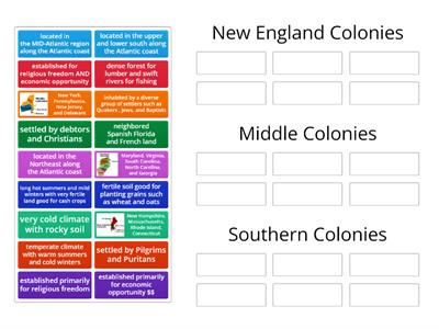
13 Colonies
Posortuj
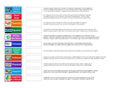
Types of Maps
Połącz w pary
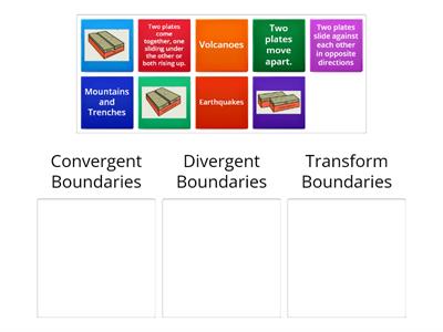
Plate Boundaries
Posortuj
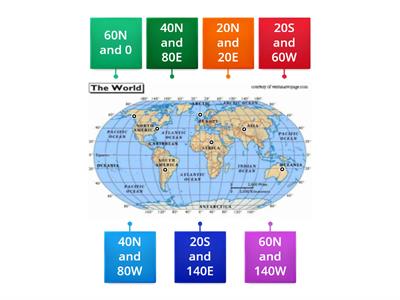
Longitude and Latitude
Rysunek z opisami
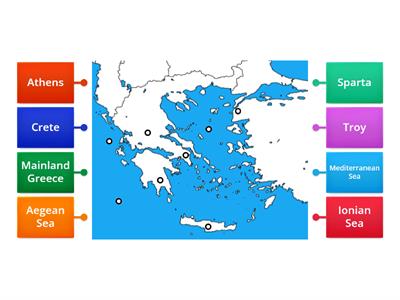
Ancient Greece Map
Rysunek z opisami
Thirteen Colonies
Rysunek z opisami
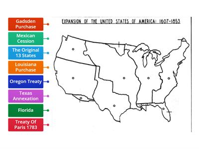
Westward Expansion Map
Rysunek z opisami
West Region
Rysunek z opisami
Southeast States & Capitals
Połącz w pary
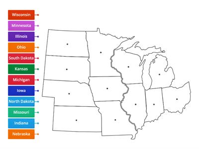
Midwest Region
Rysunek z opisami
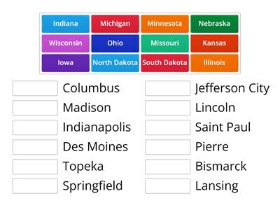
Midwest States & Capitals
Połącz w pary

