
Key Stage 3 Geography Place & locational knowledge
Exemplos da nossa comunidade
10.000+ resultados para "ks3 geography place locational knowledge"
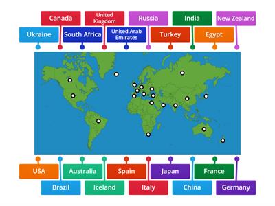
Geography world map game
Imagem com legenda
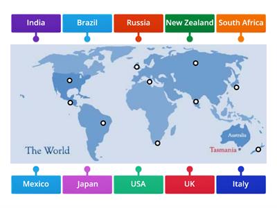
World Map: Main Countries
Imagem com legenda
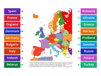
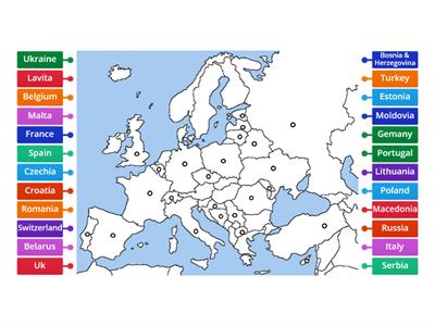
Europe countries
Imagem com legenda
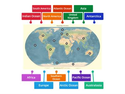
Labelling continents and oceans of the world
Imagem com legenda
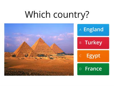
Guess the country from the photo
Questionário
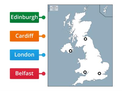
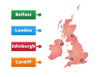
Capitals of the United Kingdom
Imagem com legenda
Britain
Imagem com legenda
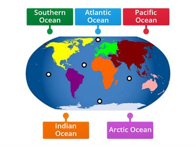
Locate the Oceans
Imagem com legenda
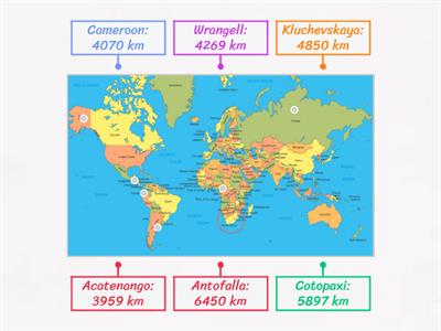
Locations of volcanoes around the world
Imagem com legenda
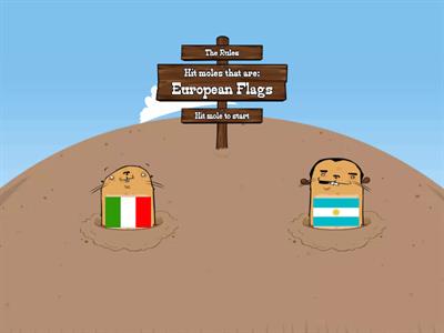
Hit the European flags
Acerte as toupeiras
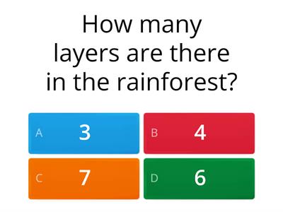
Amazon rainforest
Questionário
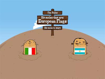
Flags of Europe
Acerte as toupeiras
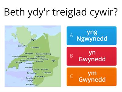
Treiglad Trwynol
Questionário
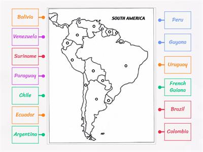
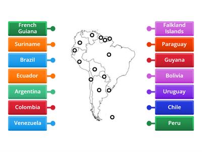
South America map
Imagem com legenda

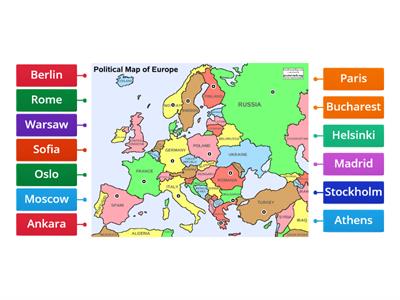
Capitals of Europe
Avião
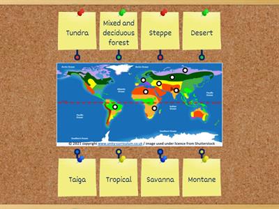
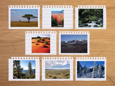
CUSP Biome identification KS2
Imagem com legenda
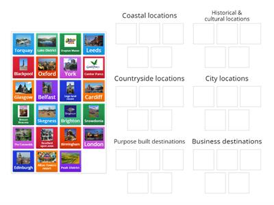
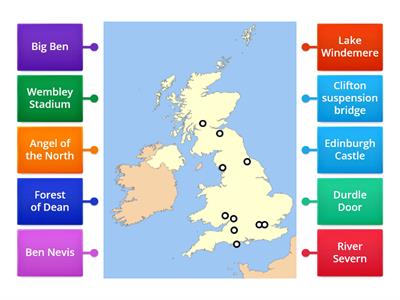
UK tourism destinations 2
Classificação em grupos
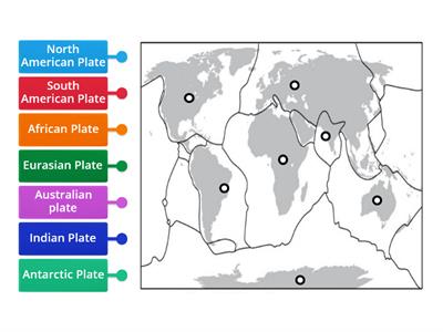
Major continental tectonic plates
Imagem com legenda
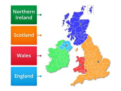
Where in the UK?
Imagem com legenda
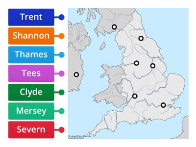
UK Rivers
Imagem com legenda
Continents Quiz
Questionário
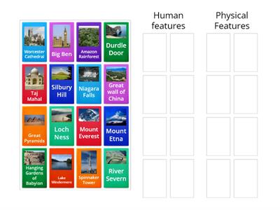
Human and physical features sort
Classificação em grupos
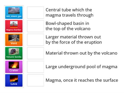
Volcanoes
Associação
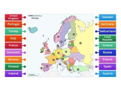
Europe
Imagem com legenda
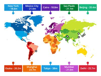
World`s Biggest Cities in 2015
Imagem com legenda
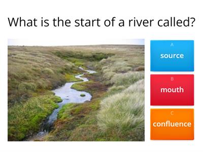
Rivers quiz
Questionário
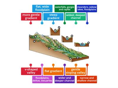
Long profile of a river
Imagem com legenda
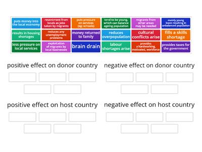
Impacts of Migration
Classificação em grupos
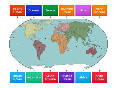
Locate the Continents and Oceans
Imagem com legenda
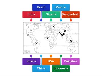
Countries with the largest population
Imagem com legenda
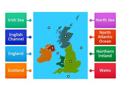
UK Countries and Seas
Imagem com legenda
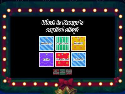
Kenya
Game show de TV
General Questions Quiz
Associação
Identify biomes
Vire as peças
South America
Imagem com legenda
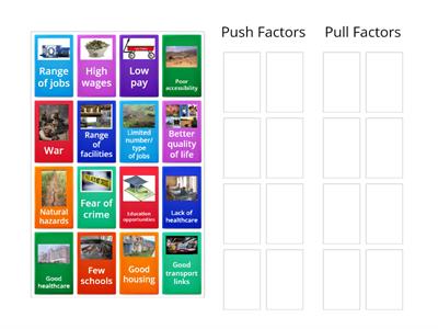
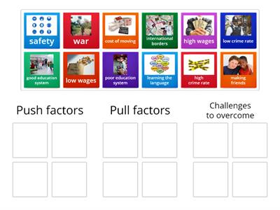
Push/pull factors sort
Classificação em grupos
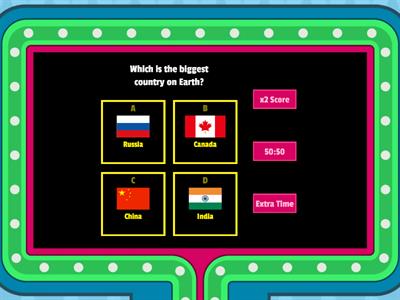
The Country Quiz!
Game show de TV
Capitals of Europe - Labelled diagram
Imagem com legenda
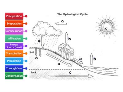
Water Cycle
Imagem com legenda
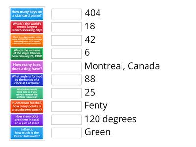
General Knowledge
Questionário
UK Capitals map
Imagem com legenda
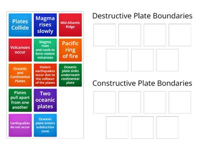
Plate boundaries
Classificação em grupos
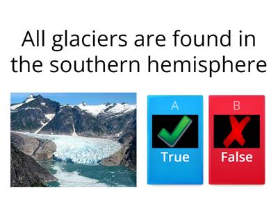
What are glaciers
Questionário
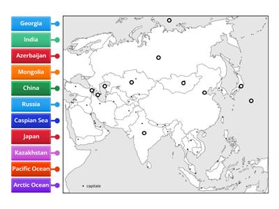
map of asia
Imagem com legenda
Plenary - Random wheel_BE
Roleta aleatória
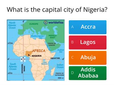
African capital cities quiz
Questionário
Rivers of the UK
Palavras cruzadas
Geography: Europe
Imagem com legenda
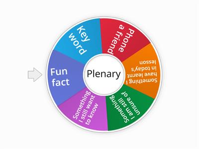
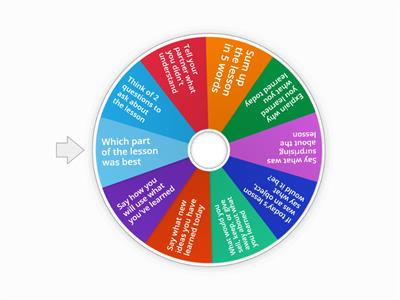
Plenary wheel
Roleta aleatória
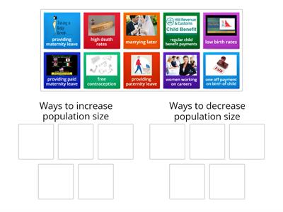
Controlling Population Size
Classificação em grupos
Why do people migrate?
Classificação em grupos
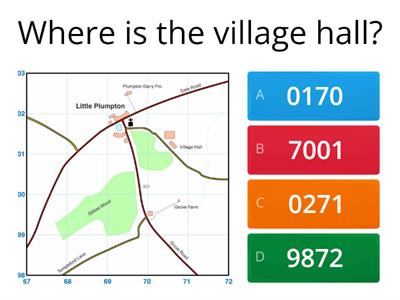
4 digit grid references on a map
Questionário
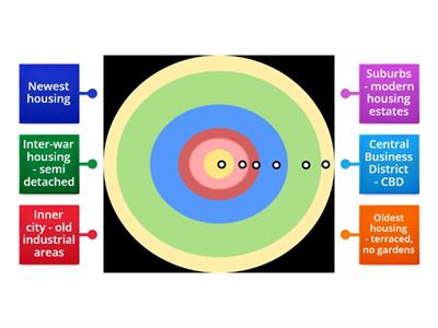
Patterns of Land Use in Urban Areas
Imagem com legenda
Cross section of a depression
Imagem com legenda
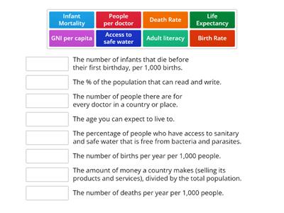
Indicators of development
Associação
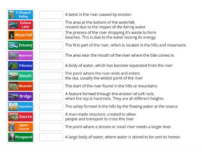
Features of a River
Associação
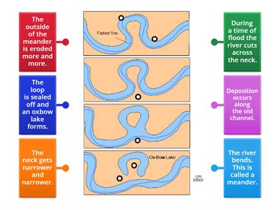
Formation of an oxbow lake
Imagem com legenda
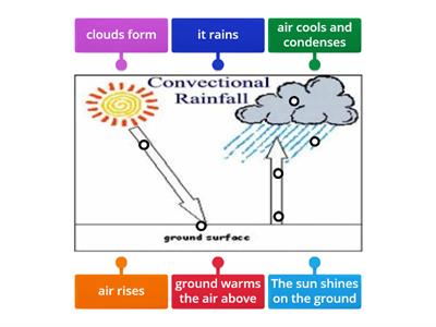
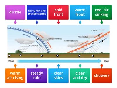
Convectional Rainfall
Imagem com legenda
Map Skills - Grid References
Imagem com legenda
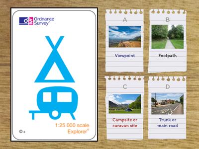
Ordnance Survey Symbols 1
Questionário

