
12th Grade Geography
Mga halimbawa mula sa aming komunidad
10,000+ mga resulta para sa ' 12th grade geography '
Countries of the World
Random wheel
4.1 Intro to Political Geog/Political Entities
Pag-uuri ng pangkat
5.6 Agricultural Production Regions: Farming Practice
Pag-uuri ng pangkat
13 Colonies Map Matching Game
Labelled Diagram
7.8 Sustainable Development Goals Quiz
Pagsusulit
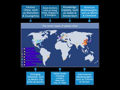
6.3 Cities & Globalization/Characteristics of World Cities
Pag-uuri ng pangkat
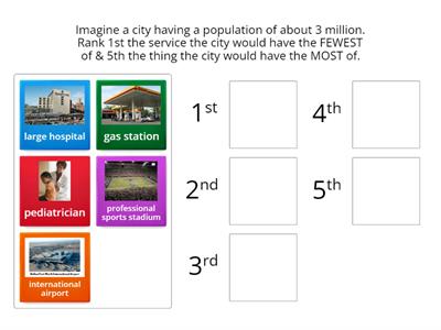
6.3 Cities & Globalization/World Cities 2020
Pagkakasunod-sunod ng ranggo
3.4 Types of Diffusion AP Human Geography Kmetz
Pag-uuri ng pangkat
3D shapes, names and faces
Pag-uuri ng pangkat
LAST NAME, first name
Labelled Diagram
5.2 Settlement Patterns & Survey Methods
Pag-uuri ng pangkat
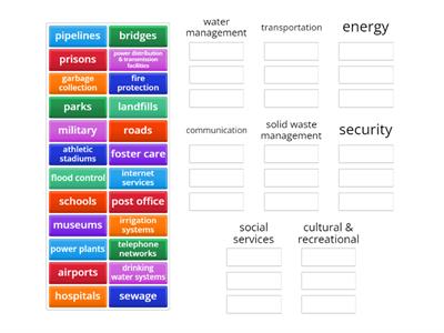
6.7 Infrastructure/Categories & Examples
Pag-uuri ng pangkat
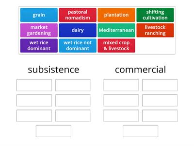
5.6 Agricultural Production Regions: Economic Purpose
Pag-uuri ng pangkat
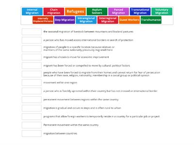
Types of Migration
Pagtutugma
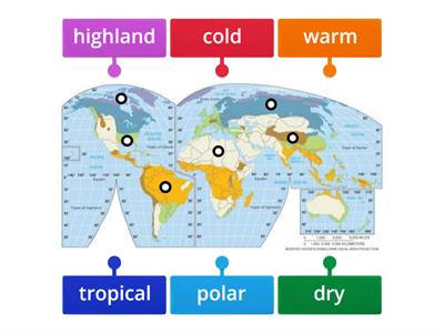
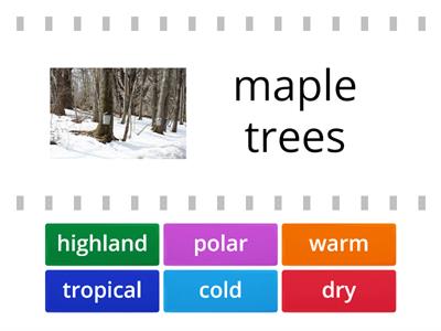
Climate Regions Map
Labelled Diagram
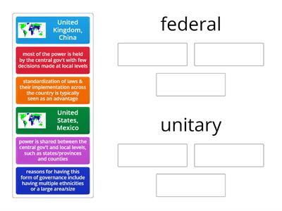
DOL 4.7 Forms of Governance
Pag-uuri ng pangkat
6.4 Central Place Theory
Pagkakasunod-sunod ng ranggo
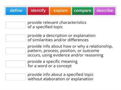
FRQ Task Verbs
Pagtutugma
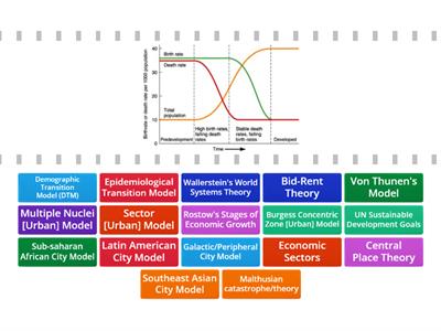
AP Human Geography Models and Theories
Hanapin ang tugma
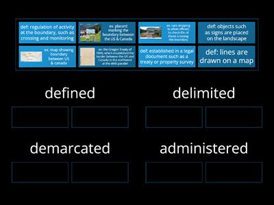
4.5 4.B.1 Nature of Boundaries
Pag-uuri ng pangkat
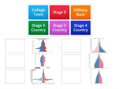
Population Pyramid Match up
Pagtutugma
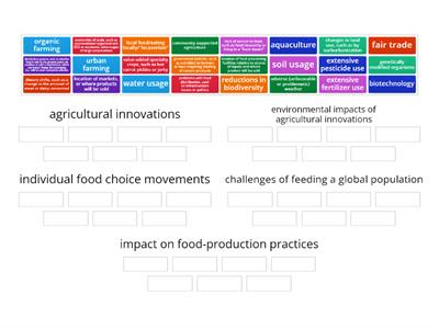
5.11 Challenges of Contemporary Agriculture
Pag-uuri ng pangkat
Urban Geography Models
Pagtutugma
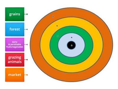
5.8 von Thunen Model
Labelled Diagram
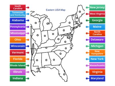
Eastern USA Map Diagram
Labelled Diagram
Futur simple
Random wheel

Building a Resume
Pag-uuri ng pangkat
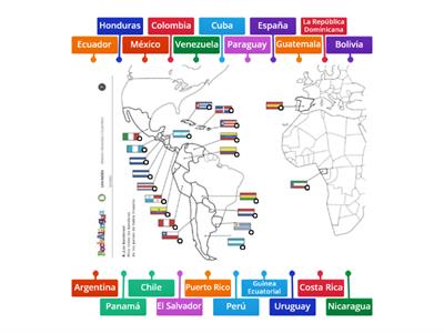
Mapa de países hispanohablantes (Spanish Speaking Countries Map)
Labelled Diagram
5.1 Intro to Agriculture/Climate
Hanapin ang tugma
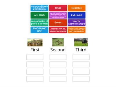
5.3-5 Agricultural Revolutions
Pag-uuri ng pangkat
Essential Questions in AP Human Geography Units 1-4
Random wheel
Essential Questions in AP Human Geography All Units
Random wheel
Logos
Pagsusulit

(Summer)
Wordsearch
Map Quiz
Labelled Diagram
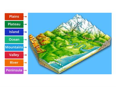
Landforms
Labelled Diagram
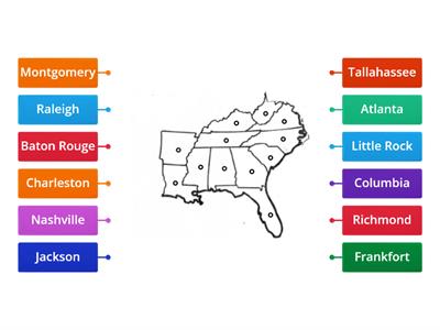
Southeast Capitals Map
Labelled Diagram
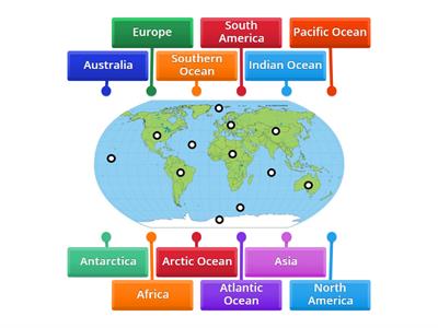
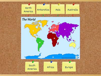
Continents and Oceans Practice Game 1
Labelled Diagram
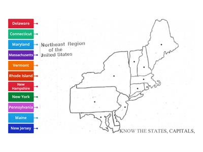
Northeast Map
Labelled Diagram
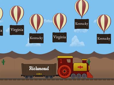
Southeast Balloon Pop
Balloon Pop
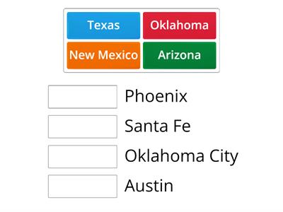
Southwest States & Capitals
Pagtutugma
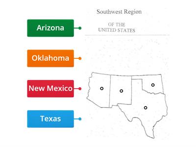
Southwest Region
Labelled Diagram
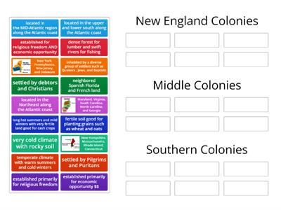
13 Colonies
Pag-uuri ng pangkat
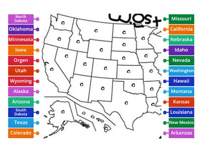
West States & Capitals
Pagtutugma
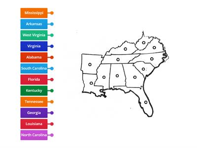
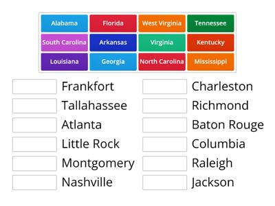
Southeast Region
Labelled Diagram
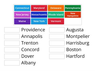
Northeast States and Capitals
Pagtutugma
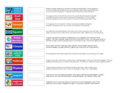
Types of Maps
Pagtutugma
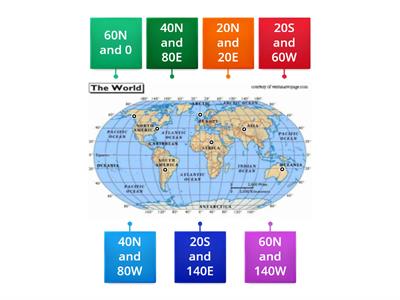
Longitude and Latitude
Labelled Diagram
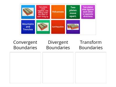
Plate Boundaries
Pag-uuri ng pangkat
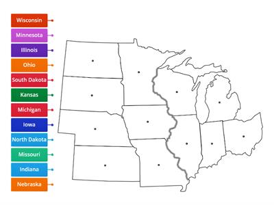
Midwest Region
Labelled Diagram
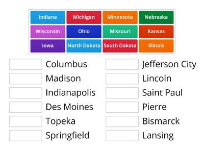
Midwest States & Capitals
Pagtutugma
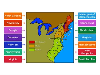
Thirteen Colonies
Labelled Diagram
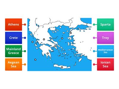
Ancient Greece Map
Labelled Diagram
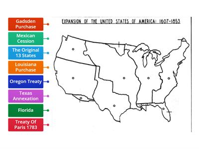
Westward Expansion Map
Labelled Diagram
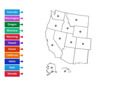
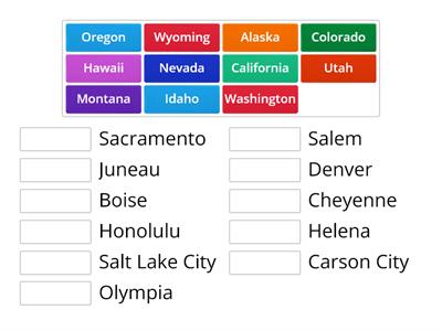
West Region
Labelled Diagram
Southeast States & Capitals
Pagtutugma
Western USA Map Diagram
Labelled Diagram
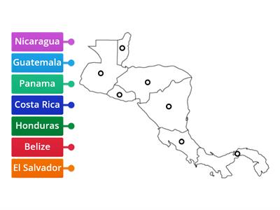
Central America Map
Labelled Diagram

